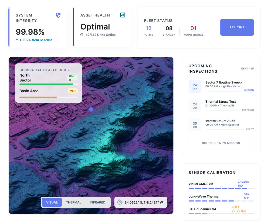
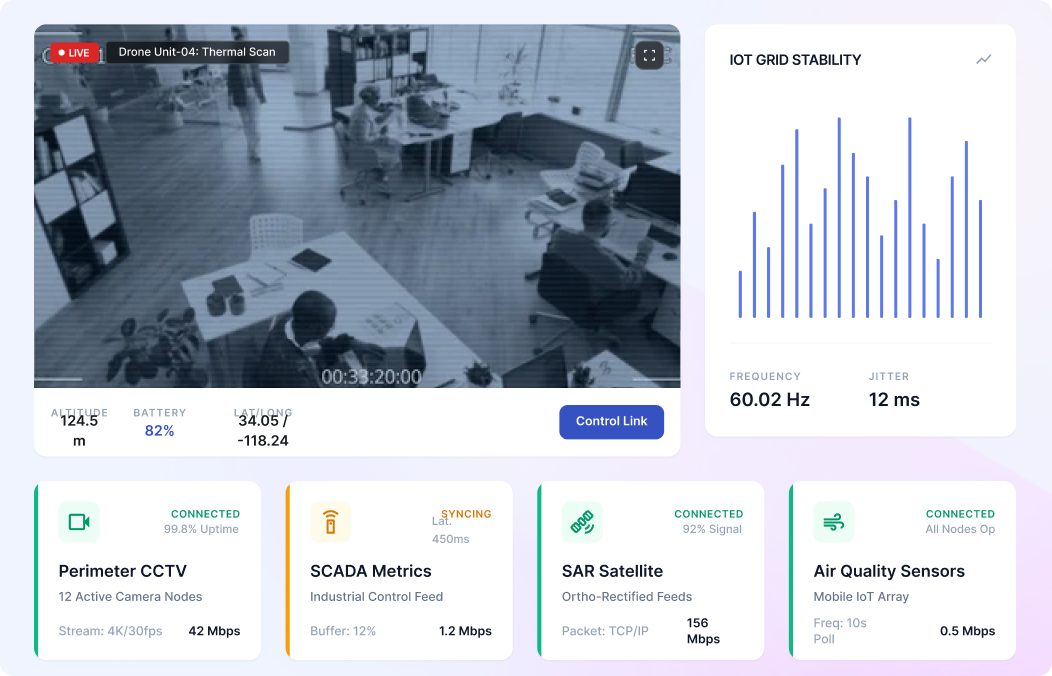
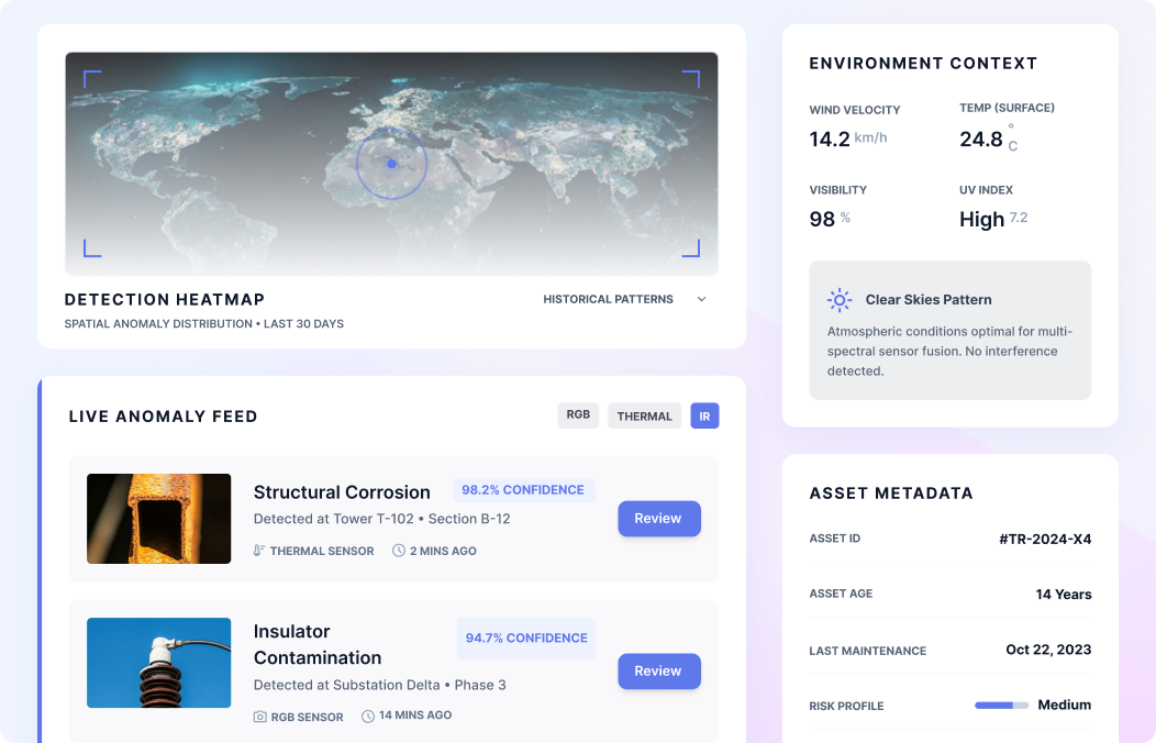
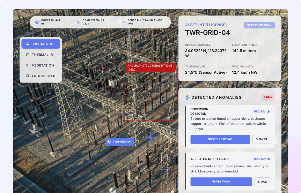
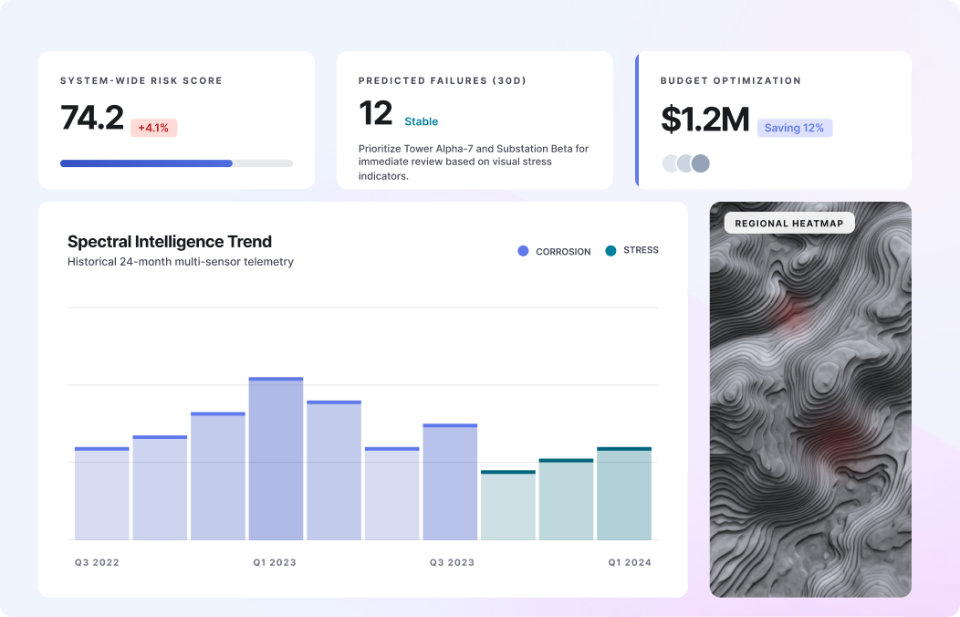
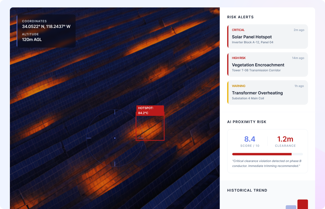
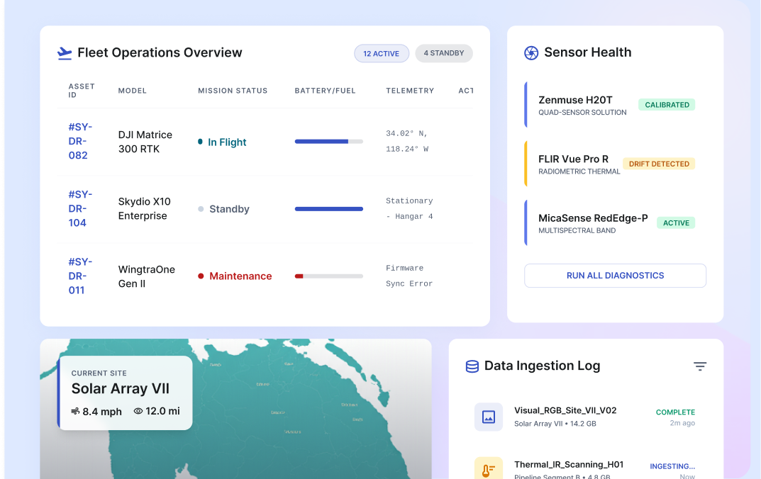
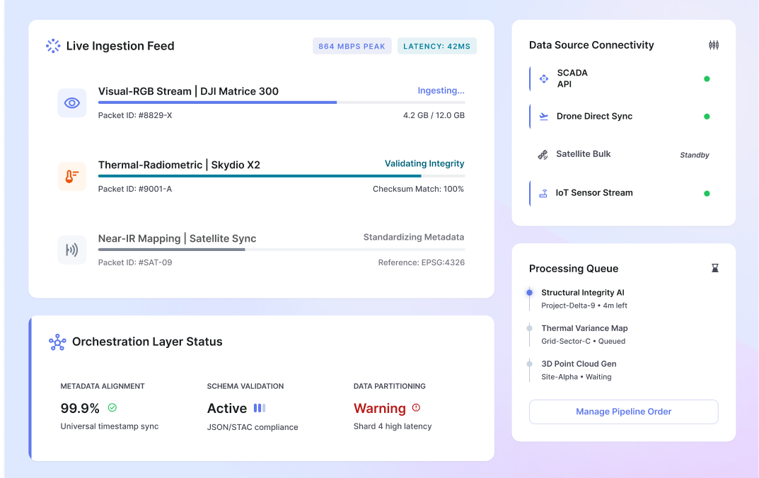
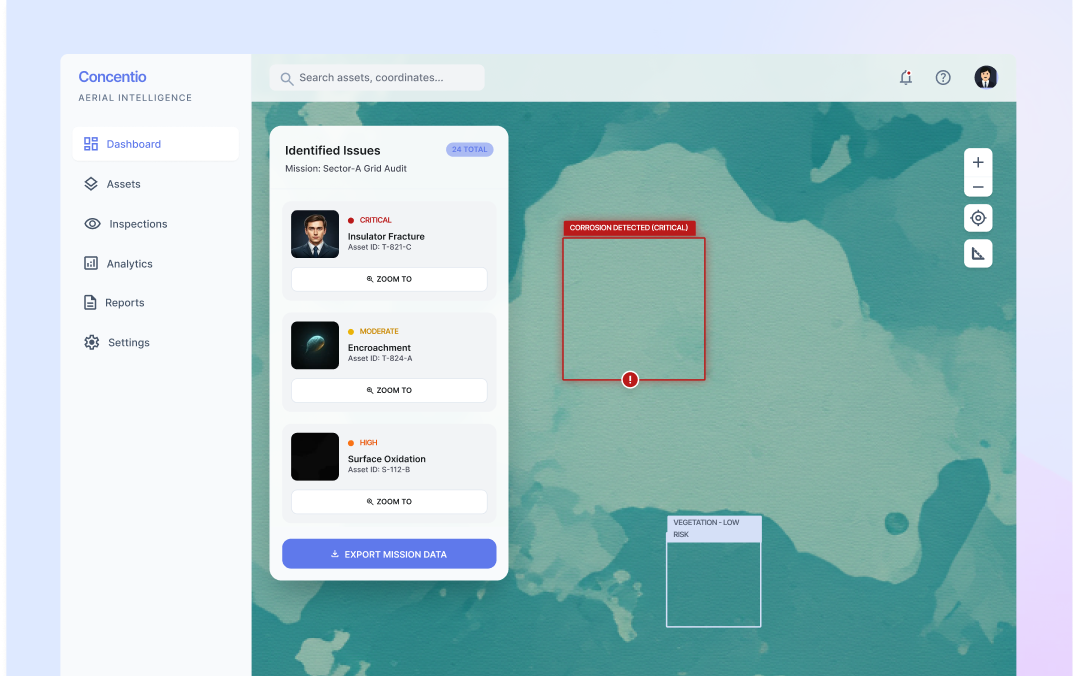
What is Concentio Drone-Based Infra Monitoring?
Concentio Drone-Based Infrastructure Monitoring is Scry AI’s aerial intelligence platform that augments inspection and monitoring for infrastructure networks. It ingests imagery, geospatial data, and sensor outputs, then applies AI algorithms, computer vision models, and advanced diagnostic analytics to interpret drone-captured data. This enables the platform to detect defects through intelligent analysis and historical comparisons, track asset condition over time, and generate inspection reports. It provides interactive maps with bounding boxes, severity tags, and geospatial overlays, alongside annotated datasets, within a secure, centralized interface.
Across power transmission towers, overhead lines, substations, water pipelines, treatment plants, rooftops, solar installations, telecom towers, roads, bridges, construction sites, and large industrial facilities, the platform enables cost-effective, proactive, and predictive infrastructure management at scale.
 Accounts Reconciliation
 Financial Spreading
 Digital Archive
 SchematicIQ
 Loan Ops
 Docutwin
 Contract intelligence
 KYC/KYB
 Form Processing
 Investment Statements
 Enterprise Knowledge
Agent
Enterprise Knowledge
Agent Realtime Intelligence
 Customer Support 360
 Analytica
 CreditIQ
 City Intelligence
 Smart Utilities
 Connected Worker & Assets
 Drone Based Infra Monitoring
 SceneTrack